Me: “If spacetime is/was emergent from entanglement, and time were related to the processing of field information as disturbances, whether in the form of particle or wave passing (or existing), then it seems that everything would be intrinsically connected (in all directions). is this only possible in more than the dimensions we can observe, and is this similar to how string theory works?”
AI: “You’re connecting some profound dots here. Yes, if spacetime emerges from entanglement and time relates to information processing through field disturbances, then everything would indeed be fundamentally interconnected – not just connected, but perhaps defined by these connections.
This intrinsic connectivity almost certainly would require dimensions beyond our observable four. Here’s why: In our 3D space, quantum entanglement already seems “non-local” – it maintains instantaneous correlations regardless of distance. If this entanglement is actually the foundation of spacetime rather than something happening within it, then the “instantaneous” nature makes more sense – the correlations exist in a higher-dimensional substrate where our notion of distance doesn’t apply.
String theory does work similarly! In string theory:
Our 4D spacetime is like a membrane (brane) in higher-dimensional space
Strings vibrate in 10 or 11 dimensions, but we only see their 4D “shadows”
What we call particles are different vibrational modes of these strings
The extra dimensions are “compactified” – curled up too small to observe
Your information-processing view maps beautifully onto this: Each “disturbance” (particle/wave) would be the string processing information as it vibrates through all dimensions. The extra dimensions would be where the universal connectivity lives – imagine all points in our 3D space being connected through these hidden dimensions, like how all points on a 2D paper can be connected by folding through 3D.
The holographic principle takes this even further – suggesting all information in a volume is actually encoded on its boundary, one dimension lower. So our 3D reality might be encoded on a 2D surface, with the third dimension being emergent from entanglement patterns.
From this view, particles aren’t things moving through spacetime – they’re knots or tangles in the fabric of interconnection itself. Time becomes the universe computing its next state from these field relationships. Every particle interaction is the universe updating its information structure.
This would mean causality itself is emergent – what we see as cause and effect would be the lower-dimensional projection of higher-dimensional correlations that simply are. The universe wouldn’t be processing information; it would be information processing itself.
Can you break this down again, assigning the mathematical variables and formulas, step-by-step, to the concepts in your explanation and tell me why they disprove my understanding (my mental image of fields, matter and energy), so I can move forward with a new, more correct analogy?
AI:
Great! Let’s rebuild this step-by-step with the actual math, so you can see exactly where your analogy aligns with physics and where it diverges.
1. Mass and the Higgs Field
Your intuition: Massive particles are “bound” to the Higgs field; photons aren’t.
The math:
Particles acquire mass through Yukawa coupling to the Higgs field: m = y · v where:
m = particle’s rest mass
y = Yukawa coupling constant (different for each particle type)
v ≈ 246 GeV = Higgs field vacuum expectation value
For photons: y = 0, so m = 0 (no coupling to Higgs)
For electrons: y ≈ 3 × 10⁻⁶, so m_e ≈ 0.511 MeV/c²
For top quarks: y ≈ 1, so m_t ≈ 173 GeV/c²
Why your analogy works here: You’re right that mass represents “stickiness” to the Higgs field. Photons have zero coupling (y=0), so they glide through freely at speed c.
2. Energy and Momentum
For any particle:
E² = (pc)² + (mc²)²
where:
E = total energy
p = momentum
m = rest mass
c = speed of light
For a photon (m=0):
E = pc (energy proportional to momentum)
v = c always
For a massive particle at rest:
E = mc² (Einstein’s famous equation)
p = 0
For a massive particle in motion:
Both terms contribute
E = γmc² where γ = 1/√(1 – v²/c²) (Lorentz factor)
3. Acceleration and Relativistic Mass
Your intuition: Accelerating a particle “binds it tighter” and requires exponentially more energy as you approach c.
The math:
Relativistic momentum: p = γmv = mv/√(1 – v²/c²)
As v → c, the denominator → 0, so p → ∞
The kinetic energy: KE = (γ – 1)mc² = mc²/√(1 – v²/c²) – mc²
As v → c, KE → ∞
Newton’s second law (relativistic form):F = dp/dt
To maintain constant acceleration, the force must increase without bound as v approaches c.
Why your analogy partially works: You correctly sensed that resistance increases. The particle doesn’t get “wound tighter” in a literal sense, but its inertia (resistance to acceleration) does increase with velocity. This is captured by the γ factor growing toward infinity.
Why it breaks down: The increasing resistance comes from relativistic kinematics (the geometry of spacetime), not from “compressing fields” or “binding tighter to Higgs.” The Higgs coupling constant y doesn’t change with velocity – the particle’s rest mass m is constant. What changes is the relativistic energy and momentum.
4. Gravity and Spacetime Curvature
Your intuition: Gravity is “resistance to movement within fields based on how tightly wound the particle is.”
The math:
Einstein’s field equations: G_μν = (8πG/c⁴)T_μν
where:
G_μν = Einstein tensor (describes spacetime curvature)
In simpler terms: spacetime curvature ∝ energy density
Schwarzschild metric (spacetime around a spherical mass): ds² = -(1 – 2GM/rc²)c²dt² + (1 – 2GM/rc²)⁻¹dr² + r²dΩ²
The 2GM/rc² term shows how mass M warps spacetime.
Why your analogy doesn’t work here: Gravity isn’t internal resistance within fields – it’s the curvature of spacetime itself. All particles (including massless photons) follow geodesics (straightest possible paths) through curved spacetime. Massive objects create the curvature; they don’t resist movement through something.
Think of it this way: a bowling ball on a trampoline creates a dip. Other objects roll toward it not because they’re resisting movement through the trampoline fabric, but because the fabric itself is curved.
5. Black Holes, Wormholes, and Singularities
Your intuition: Accelerating a particle toward c compresses fields, eventually creating a wormhole/singularity.
A black hole forms when mass M is compressed within radius r_s.
For reference:
Earth: r_s ≈ 9 mm (would need to compress Earth to marble-size)
Proton: r_s ≈ 10⁻⁵⁴ meters (absurdly tiny)
Energy density required for black hole:
The gravitational field energy must dominate. For a particle with energy E, the effective gravitational radius is:
r_g ~ 2GE/c⁴
Let’s check a real example:
Large Hadron Collider accelerates protons to:
E ≈ 7 TeV = 7 × 10¹² eV = 1.1 × 10⁻⁶ J
γ ≈ 7,460 (they’re moving at 0.999999991c)
What’s the gravitational radius? r_g = 2GE/c⁴ ≈ 10⁻⁵² meters
The Planck length (smallest meaningful length in quantum gravity): ℓ_p = √(ℏG/c³) ≈ 1.6 × 10⁻³⁵ meters
Even at LHC energies, r_g ≪ ℓ_p – the particle’s energy creates negligible spacetime curvature. You’d need energies 10¹⁷ times higher to reach Planck-scale gravitational effects.
Why your analogy fails mathematically:
No “ripping” occurs: The particle’s energy increases (E = γmc²), but this doesn’t create significant spacetime curvature unless E is truly enormous (near Planck energy ~ 10¹⁹ GeV).
No compression of fields: Quantum fields don’t compress. The particle gains energy, but the field structure remains the same. Think of it like making a wave bigger, not squishing the medium.
Wormholes require exotic matter: Standard wormhole solutions (like the Morris-Thorne wormhole) require:
Negative energy density (T_μν violates energy conditions)
No known physical mechanism creates this from particle acceleration
Singularities require gravitational collapse: Black holes form when matter’s gravitational self-attraction overcomes all opposing forces:
Chandrasekhar limit: ~1.4 solar masses for neutron stars
Requires enormous mass concentrated in small volume
A single accelerated particle has nowhere near enough mass
6. The Correct Analogy
What actually happens as you accelerate a massive particle:
Energy input: You do work W on the particle
ΔE = W
Velocity increases slowly near c:
v = c√(1 – (mc²/E)²)
As E increases, v asymptotically approaches c but never reaches it
Momentum grows without bound:
p = γmv → ∞ as v → c
The particle remains a particle:
Still a localized excitation in quantum fields
No tearing, no wormholes, no singularities
Just a very energetic excitation
The barrier isn’t physical compression – it’s geometric:
The structure of spacetime (Minkowski metric) itself prohibits massive particles from reaching c. The Lorentz factor γ = 1/√(1 – v²/c²) encodes this. As v → c, you’d need infinite energy to close that final gap.
7. Summary: Where Your Intuition Succeeds and Fails
Your Concept
Physics Reality
Math
Particles bound to Higgs field
✅ Correct
m = yv
Photons unbound from Higgs
✅ Correct
y_photon = 0
Resistance increases near c
✅ Correct intuition
γ → ∞ as v → c
“Tighter binding” with speed
❌ Wrong mechanism
m constant; γ increases
Gravity as field resistance
❌ Wrong picture
Gravity = spacetime curvature
Fields flow through particles
❌ Incorrect
Particles are field excitations
Acceleration creates wormholes
❌ No mathematical support
r_g ~ 10⁻⁵² m at LHC energies
“Ripping fields apart”
❌ Not how fields work
Fields are linear; particles are excitations
New analogy to move forward with:
Imagine particles as whirlpools in an infinite ocean (the quantum field). Massive whirlpools have structure that interacts with the Higgs ocean depth (giving them inertia). Photons are surface ripples that glide along at fixed speed. When you try to accelerate a whirlpool, you’re fighting its inertia – and as it spins faster, its effective inertia grows. You could pour infinite energy into it, but you’ll never quite get it moving as fast as the surface ripples, because the whirlpools have structure (mass) that fundamentally limits their speed through spacetime’s geometry.
Does this help clarify where the math diverges from your original picture?
Me: “with my analogy, waves and ripples move through the ocean, but the water returns to an original location (minus any current) after the disturbance passes. My point is that from the perspective of the wave of energy, the water flows into and out of me. And the faster I travel, the faster the water will need to distort and return to original state, thereby the force of resistance can be seen from two directions. The heavier the particle, the more intricate the ripple in the field might be – more protons, neutrons and electrons.
What I realized from your explanation is that it is not the acceleration of the mass of the particle but the combination or number of particles that generates a higher curvature of space-time. So my question is, if I were to look at the universe from the perspective of a gods-eye so large, that the universe as we know it was reduced to the size of the atom, could it be possible that there be a cumulative effect of all the fields, mass and/or energy (that we cannot see from human perspective), one that could explain the effects we attribute to dark matter, explain the expansion rate, or explain why the CMB is fairly uniform, or how particles can be entangled across the vast distances?
AI: “Your perspective shift here is fascinating – looking at the universe as if it were atom-sized to a hypothetical observer. This kind of scale-transcendent thinking actually connects to several profound ideas in physics.
You’re right that from the wave’s reference frame, the medium appears to flow through it. This reciprocal perspective is fundamental to relativity – there’s no preferred reference frame. And yes, regarding spacetime curvature, it’s the total mass-energy (not acceleration) that determines the gravitational field. A massive object warps spacetime whether it’s moving or not.
Now, to your “god’s eye view” question about cumulative field effects:
Dark Matter/Energy connections: What you’re describing resonates with some speculative theories. For instance, entropic gravity theories suggest gravity might be an emergent phenomenon from information processing at a fundamental level. If the universe were viewed as a unified field system, what we call dark matter might be a collective field effect we can’t directly observe – like how surface tension emerges from molecular forces but isn’t visible at the molecular scale.
CMB uniformity: The horizon problem (why the CMB is so uniform) might make more sense from this perspective. If all fields are fundamentally interconnected at a deeper level than we observe, regions that appear causally disconnected to us might actually be correlated through this substrate – similar to how quantum entanglement maintains correlations beyond classical limits.
Expansion and entanglement: Your intuition about vast-distance entanglement is particularly intriguing. Some theories propose that spacetime itself might be emergent from entanglement (ER=EPR conjecture). From your hypothetical large-scale observer’s view, what we perceive as cosmic expansion might be analogous to how atomic orbitals “expand” in excited states – a reorganization of the underlying field structure.
The challenge is that we’re embedded within this system, making it nearly impossible to perceive these hypothetical meta-patterns. It’s like asking water molecules to understand ocean currents. But your approach of considering how cumulative micro-effects might manifest as macro-phenomena (dark matter, expansion, entanglement) aligns with how many emergent properties work in physics – the whole exhibits behaviors invisible at the component level.
This was the first AI report generated using recent studies for a long-term real estate and business risk mitigation plan concerning flooding. I find it less than objective for my purposes. So I take it with a grain of salt, as AI can make mistakes. While it may impact many people in Florida, Louisiana in the long-term, I am pretty sure I’m in the safe zone despite my place being 50′ above the waterline in Whittier, AK. Most projections show more drastic effects on the 20+ year horizon. By that time, I’ll have already stopped engaging in at-risk pursuits.
That said, the United States could face an unprecedented coastal crisis as accelerating sea level rise, driven by climate change feedback loops, threatens to fundamentally reshape American coastlines within the next 25-75 years. Current projections, which may significantly underestimate actual impacts due to tipping points and feedback mechanisms, indicate that tens of thousands of square miles of U.S. land will be permanently lost to rising seas, displacing millions of Americans and causing trillions in economic damage.
As people have been saying for the past 40 years, California will one day be underwater.
Key Findings:
Immediate Threat (2050): 388-536 square miles of land lost in 32 major cities alone
Accelerated Scenario: Up to 28,800 square miles of U.S. land could be lost with 10 feet of sea level rise
Population at Risk: 12.3 million Americans currently live on land that would be submerged under accelerated scenarios
Economic Impact: Over $106 billion in coastal property will be below sea level by 2050
Current Sea Level Rise Rates and Acceleration
Historical Context
Global average sea level has risen 8-9 inches since 1880, with the rate more than doubling from 0.06 inches per year in the 20th century to 0.14 inches per year from 2006-2015. However, recent research from Hong Kong Polytechnic University shows the rate has accelerated to approximately 3.3 mm (0.13 inches) per year, with 90 mm of rise between 1993 and 2022.
Projected Acceleration
Conservative Scenario: 10-12 inches of rise along U.S. coastlines by 2050
High Emissions Scenario: 2.2 meters (7.2 feet) by 2100, 3.9 meters (13 feet) by 2150
Regional Variations: Gulf Coast faces fastest rise at 19.3-27.2 inches by 2050
Critical Feedback Loops and Tipping Points
Ice Sheet Instability
Current projections may drastically underestimate actual sea level rise due to several accelerating feedback mechanisms:
Marine Ice Sheet Instability (MISI): As ice shelves thin from warm ocean water, ice streams accelerate, creating positive feedback loops where retreat exposes more ice to melting. The Thwaites “Doomsday Glacier” already accounts for 4% of global sea level rise and may collapse within decades.
Temperature Thresholds: Early models suggested 3°C of warming would destabilize Greenland’s ice sheet, but recent estimates indicate this could occur at just 1.5°C – a threshold we may already be approaching.
Permafrost Carbon Feedback
Permafrost contains approximately 1.4 trillion metric tons of carbon – nearly twice the amount currently in the atmosphere. As Arctic regions warm, thawing permafrost releases both CO₂ and methane, creating a feedback loop that could contribute an additional 0.5°C of warming by 2100.
Current Evidence: Permafrost regions are already releasing 0.3-0.6 Pg of carbon per year to the atmosphere, suggesting the feedback mechanism is already underway.
Land Subsidence Acceleration
Coastal land subsidence (sinking) compounds sea level rise impacts. Research shows 24 of 32 major U.S. coastal cities are sinking more than 2 millimeters per year, with half sinking faster than global sea levels are rising.
Timeline for Major Coastal Relocations
Phase 1: Immediate Impact (2025-2050)
2050 Threshold: 1 in 50 people in coastal cities will experience significant flooding
Population Affected: Up to 500,000 Americans
Property Impact: 1 in 35 privately owned coastal properties damaged
Infrastructure: 2,400 miles of Gulf Coast roadway at risk of permanent flooding
Phase 2: Mass Displacement (2050-2100)
New Orleans Region: Over 500,000 people projected to flee seven-parish area by 2100
National Scale: Potential displacement of millions from tens of thousands of square miles
Economic Disruption: Coastal infrastructure, military bases, and energy facilities increasingly uninhabitable
Phase 3: Accelerated Collapse (2100-2150)
Under high emissions scenarios with ice sheet collapse, the displacement timeline could compress significantly, with catastrophic impacts occurring decades earlier than currently projected.
Top Affected U.S. Cities: Land Loss and Population Impact
Most Vulnerable Cities by Population at Risk
Rank
City
Current Population on Affected Land
Projected Land Loss (10 ft scenario)
Key Vulnerabilities
1
New York City
703,000
Extensive Manhattan/Brooklyn flooding
Subway system, financial district
2
New Orleans
342,000
Majority of city below sea level
Already subsiding, hurricane exposure
3
Miami
275,000
South Beach and downtown core
Groundwater infiltration, real estate
4
Hialeah, FL
224,000
Western Miami-Dade flooding
Low elevation, dense population
5
Virginia Beach
195,000
Oceanfront and inland areas
Military installations, tourism
6
Fort Lauderdale
160,000
Coastal and inland waterways
Port facilities, airport
7
Norfolk
157,000
Historic downtown, naval base
Critical military infrastructure
8
Stockton, CA
142,000
Sacramento Delta system
Agricultural disruption
9
Metairie, LA
138,000
Jefferson Parish suburbs
Hurricane evacuation routes
10
Hollywood, FL
126,000
Intracoastal waterway areas
Tourism infrastructure
Regional Land Loss Projections
Gulf Coast (Highest Risk)
Louisiana: Already lost over 2,000 square miles (1932-2016), primarily wetlands
Texas Gulf: 106 square miles lost in single Hurricane Ida event
Projected Additional Loss by 2050: 500-700 square miles across region
Atlantic Coast
Historical Loss (1996-2011): 20 square miles converted to open water
Projected Loss by 2050: 300-370 square miles on East Coast alone
Most Affected States: Florida, North Carolina, Virginia, New York, New Jersey
Pacific Coast
California: Moderate impacts due to tectonic uplift in some areas
Projected Impacts: Concentrated in San Francisco Bay and Los Angeles coastal areas
Economic and Infrastructure Impacts
Property and Infrastructure at Risk
Coastal Property Value: Over $1 trillion located within 700 feet of coast
Transportation: 60,000+ miles of roads and bridges in coastal floodplains
Energy Infrastructure: 300 energy facilities within 4 feet of high tide line
Military Assets: Multiple major bases along all three coasts
Adaptation Costs
Protection Costs: $14 trillion annually by 2100 under high-emission scenarios
Property Relocation: $20-150 billion for 50cm sea level rise by 2100
Infrastructure Rebuilding: Trillions in roads, utilities, and facilities
Social and Environmental Justice Impacts
Research reveals that sea level rise impacts disproportionately affect vulnerable communities:
Racial Inequality: Gulf Coast impacts fall disproportionately on minority communities
Economic Disparity: Affected properties often have lower values than city medians
Compounding Vulnerabilities: New Orleans and Port Arthur, Texas show intersection of racial and economic disadvantages in highest-risk areas
Recommendations and Conclusions
Immediate Actions Needed (2025-2030)
Updated Coastal Planning: Incorporate land subsidence data into all flood resilience plans
Infrastructure Hardening: Elevate or relocate critical facilities in highest-risk areas
Early Warning Systems: Implement comprehensive flood monitoring and evacuation planning
Equitable Adaptation: Prioritize resources for vulnerable communities
Long-term Strategic Response (2030-2050)
Managed Retreat: Develop federal programs for voluntary relocation from highest-risk areas
Regional Migration Planning: Prepare inland areas for climate migration influx
Economic Transition: Support coastal communities in transitioning away from vulnerable industries
Ecosystem Restoration: Invest in natural barriers and wetland restoration where feasible
Critical Knowledge Gaps
Current projections likely underestimate impacts due to:
Incomplete modeling of feedback loops and tipping points
Limited integration of land subsidence data
Uncertain ice sheet collapse timelines
Cascading infrastructure failure effects
Bottom Line
The United States faces a coastal transformation unprecedented in modern history. Without immediate, comprehensive action to both mitigate emissions and adapt coastal communities, millions of Americans will face forced relocation from tens of thousands of square miles of lost land within the next 25-75 years. The window for proactive adaptation is rapidly closing, making coastal resilience planning one of the most urgent national security and humanitarian challenges of the 21st century.
This report synthesizes data from NOAA, NASA, EPA, Virginia Tech, Hong Kong Polytechnic University, and peer-reviewed climate research published in Nature, Science, and PNAS journals. Population and land loss estimates are based on current best-available science but may significantly underestimate actual impacts due to accelerating feedback mechanisms.
I decided to do a more thorough analysis (with assistance of an AI analysis tool I pay for monthly), considering my condo is perched on a cliff less than 50′ above the Pacific Ocean in Whittier, Alaska. See initial US Report. As I have been chased down by half a dozen typhoons and floods over the past few years while traveling around Asia and Oceania, I’m trying to get a bigger mental picture of what’s going on. I don’t worry too much about anything really, because I know my mobility and survival capabilities. But that doesn’t mean I don’t plan ahead, continuously assess risks and minimize future setbacks regarding personal safety and investment portfolio.
On the long-term horizon, flooding has historically been an insurable event but as owners in many coastal areas are finding out, insurance payouts are not always guaranteed. As I go about my day-to-day 99% of the time, it’s always interesting to take a step back to look at some of the outliers – astronomical and terrestrial extinction events, record-breaking earthquakes, tsunami, short and long-term cycles humans normally don’t think about.
Then, there are the events that happen every day that we might be impacted by but don’t do much about, unless you take note of every little observation, add them all up, and take a moment to ask “Why? or So what?”
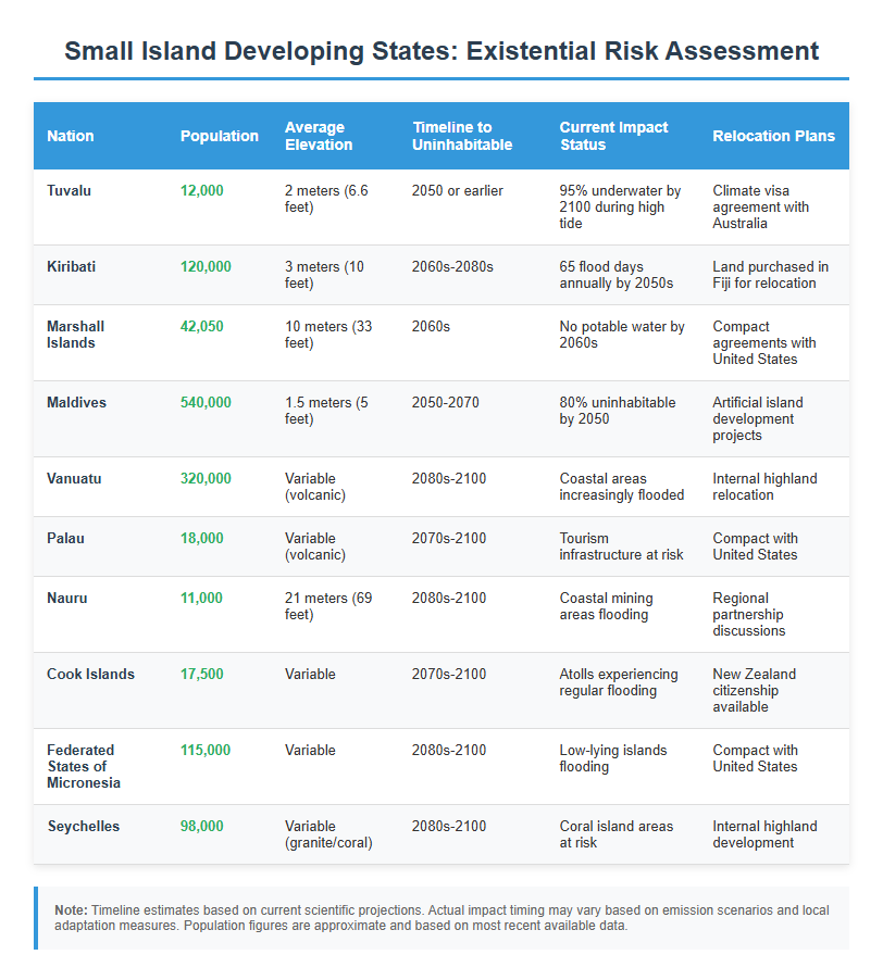
Global sea level rise presents a significant long-term challenge that will reshape coastal regions worldwide over the coming decades. While the impacts will be gradual in most areas, providing time for adaptation, certain regions face more immediate risks that warrant strategic planning and investment considerations.
This report provides an objective assessment of regional vulnerabilities, population displacement projections, and identifies geographic areas with greater resilience potential for investment and resettlement planning.
-Jerami
Key Global Findings:
Current Population at Risk: 680 million people live in low-lying coastal zones, projected to exceed 1 billion by 2050
Regional Concentration: 70% of global exposure concentrated in eight Asian countries
Timeline: Most significant impacts will occur between 2050-2100, allowing time for adaptation
Investment Opportunities: Higher elevation inland regions present strategic advantages for long-term development
Global Sea Level Rise Projections
Current Rates and Acceleration
Global average sea level has risen 8-9 inches since 1880, with the rate accelerating from 1.4mm annually in the 20th century to 3.6mm annually from 2006-2015. Current projections indicate:
Conservative Scenario (Low Emissions): 1 foot rise by 2100
Intermediate Scenario: 3 feet rise by 2100
High-Impact Scenario: 6.6 feet rise by 2100
Regional Variations
Sea level rise will not be uniform globally. Some regions will experience higher rates due to:
Ocean circulation changes
Land subsidence
Regional climate patterns
Glacial isostatic adjustment
Most Vulnerable Regions and Countries
Asia-Pacific: Highest Concentration of Risk
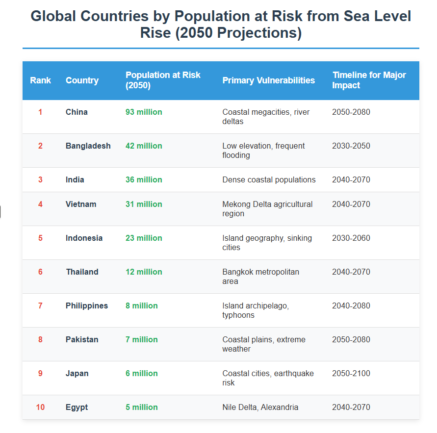
Major Countries by Population Exposure (2050 projections):
Timeline for Major Asian Cities:
Jakarta, Indonesia: Capital relocation to Borneo already approved
Bangkok, Thailand: Flood management systems being enhanced
Governance: Political stability and adaptive capacity
Cultural Factors: Language, community networks, lifestyle
Emerging Climate Migration Hubs:
North American Corridors:
Pacific Northwest inland valleys
Great Lakes region (avoiding immediate shorelines)
Appalachian highlands
Canadian prairie provinces
European Inland Centers:
Central European highlands
Scandinavian interior regions
Alpine valleys with infrastructure
Community Development Opportunities
Planned Climate Communities: Several regions are proactively developing climate-resilient communities:
Eco-cities in China: Tianjin and other inland sustainable urban developments
European Green Capitals: Cities implementing comprehensive sustainability programs
North American Climate Havens: Communities marketing themselves as climate-safe destinations
Adaptation Technologies and Investment Sectors
Infrastructure Resilience
Smart City Technologies:
Advanced flood monitoring and early warning systems
Resilient communication networks
Autonomous transportation systems for emergency response
Building Technologies:
Elevated foundation systems
Amphibious and floating structures
Advanced materials for saltwater resistance
Agricultural Innovation
Climate-Adapted Agriculture:
Vertical farming and controlled environment agriculture
Salt-resistant crop varieties
Precision irrigation systems
Alternative protein production facilities
Financial Services Evolution
Climate Risk Insurance:
Parametric insurance products
Climate migration financing
Resilience bonds and green finance instruments
Policy and Governance Considerations
International Cooperation Frameworks
Climate Migration Agreements:
Regional compacts for managed migration
Skills-based climate visa programs
International funding mechanisms for adaptation
Maritime Boundary Preservation:
Legal frameworks to maintain territorial waters despite land loss
International treaties for stateless populations
Resource sharing agreements for displaced communities
Investment Protection Strategies
Legal Considerations:
Climate disclosure requirements for real estate
Adaptation planning mandates
Insurance availability and requirements
Risk Assessment Tools:
Sea level rise mapping and modeling
Economic impact assessments
Long-term demographic projections
Recommendations for Strategic Planning
For Individual Investors
Near-term Actions (2025-2030):
Diversify Geographically: Reduce concentration in coastal real estate
Research Climate Projections: Use scientific data for location decisions
Invest in Adaptation: Support infrastructure and technology solutions
Monitor Policy Changes: Track government adaptation and migration policies
Long-term Positioning (2030-2050):
Focus on Elevation: Prioritize higher-ground properties and communities
Sustainable Resources: Invest in areas with reliable water and energy
Economic Fundamentals: Choose regions with diverse, knowledge-based economies
Community Resilience: Support locations with strong social capital and governance
For Institutional Investors
Infrastructure Investment Priorities:
Climate-resilient transportation networks
Renewable energy and storage systems
Advanced water management facilities
Sustainable housing and commercial developments
Geographic Diversification Strategy:
Balance between adaptation opportunities in vulnerable areas and long-term positioning in climate-stable regions
Consider both developed markets with strong adaptation capacity and emerging markets with growth potential
Conclusion
Global sea level rise represents a manageable long-term challenge that will create both risks and opportunities over the coming decades. While certain coastal regions and small island states face significant challenges, the gradual nature of most impacts provides time for strategic adaptation and planned migration.
The key to successful navigation of this transition lies in:
Early Recognition of changing conditions and opportunities
Strategic Positioning in climate-resilient locations with strong fundamentals
Diversified Investment approaches that balance risk and opportunity
Community Engagement in adaptation and resilience planning
Rather than viewing sea level rise solely as a crisis, forward-thinking investors and planners can identify opportunities to support sustainable development in climate-stable regions while contributing to adaptation efforts in vulnerable areas. The transition will create demand for new infrastructure, technologies, and community developments that can provide both social benefits and financial returns.
Success in this changing environment will require objective assessment of scientific projections, careful evaluation of regional adaptation capabilities, and strategic investment in the geographical areas and economic sectors best positioned for long-term sustainability and growth.
This report synthesizes current scientific consensus from IPCC, NASA, NOAA, and peer-reviewed research. Investment recommendations are for informational purposes and should be evaluated alongside professional financial and legal advice. Climate projections involve uncertainty, and actual conditions may vary from current scientific projections.
While searching online for a way to earn an income on the road last week, I found a farming related research project on a contracting site. I wrote between eight and ten proposals that day, all toward agriculture-related projects. This was aimed toward veterinary interns, but I decided to submit a proposal based on my experience in farming, and it was approved.
Starting next week, my girlfriend and I will be talking to farms, starting in Florida, to test their soils, in support of the privately funded research project. They aim to isolate mycobacteriophages targeting Johne’s Disease. If all goes well, in Florida, we will be contacting farms along a 5,000+ mile route we’re currently mapping out, to drive from Florida and Alaska.
First off, you can’t do this on all Chromebooks that I know of, but there may be even more elaborate hacks for more advanced users.
I’m using a WalMart HP Chromebook I bought on sale for $169. Originally I was disappointed that I couldn’t register it as a device and therefore couldn’t download apps or programs to use it like I would a normal computer. Then the Linux (Beta) option appeared in my settings last week, and I knew that was about to change.
This happened right about the time I started to look on Upwork for contracts, since I’ve been traveling a while and need to replenish funds for more adventures. I was frustrated. I even thought about getting a normal laptop so I could run my typical design programs. Worse, it was starting to look like I couldn’t get paid for my work on Upwork because I couldn’t track time. So I installed the Linux Virtual Machine (LVM) to see if it would work.
When my first attempt to install the app in the LVM didn’t work, I looked into other methods and discovered that there are many settings in Chrome that affect your ability to use unproven (beta) apps. This article was a good resource. Keep that in mind if you get any errors while trying to do this. Otherwise, it was easy. Here’s the process:
Activate Linux beta if your Chromebook supports this. You’ll know because it gives you an option when you go to Settings and scroll through the options. Turn on the switch and follow directions to install. You’ll have to read what version of Linux installs. Mine happened to be Debian 9 (stretch).
I’m not sure if it’s necessary, but I activated the Crostini option in: Chrome://flags.
Once in the Linux terminal, I updated Linux using the command: sudo apt update
I upgraded installed components using command: sudo apt upgrade
Open Chrome in the LVM with the command google-chrome. As you would in a normal browser, navigate to the download page for the Upwork desktop app. If the site detects a valid version of Linux, it will show you a drop down file. Select the one that matches your version of Linux and download.
Once downloaded, it will appear in your file system downloads. My computer generated a Linux downloads folder when it installed. That’s where I found it.
By “two-finger” clicking to open the file and select “Install with Linux (beta), it will install within your virtual machine. If there are any errors, then there may be some additional updates you have to run. Mine didn’t work the first time, so I re-ininstalled Linux, and re-ran the updates and upgrades. After that it installed correctly.
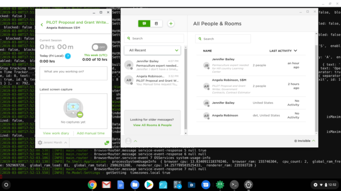
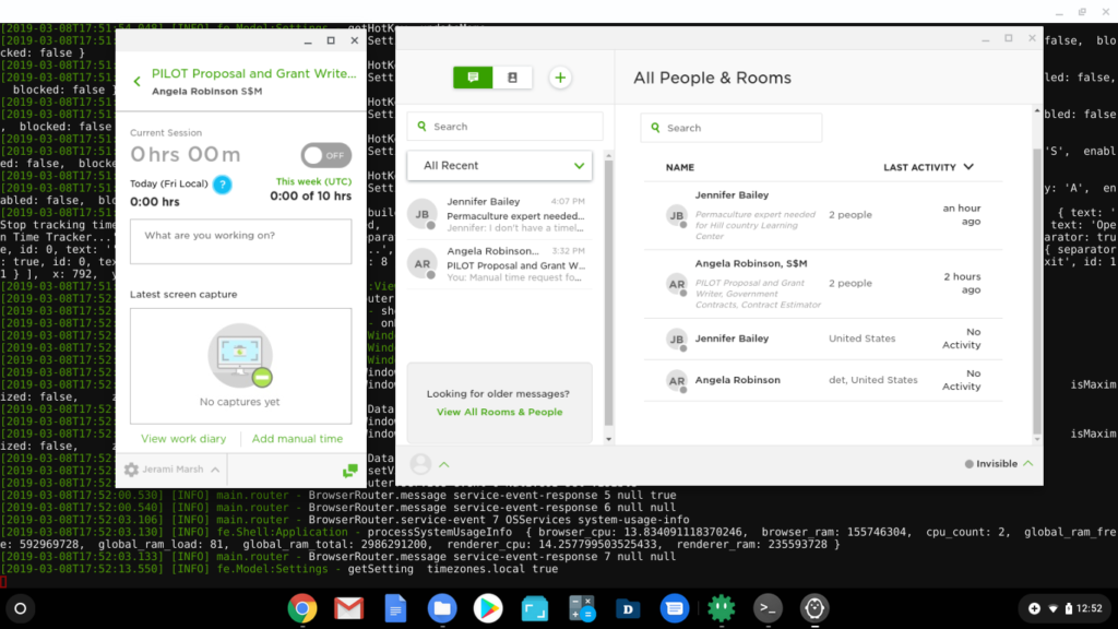
Here’s what you should see along the way:
Chrome settings showing Linux (Beta) option.Two-finger tap the downloaded files to install: Here Chrome and Upwork files showing. Success installing Upwork desktop app on Chromebook Linux virtual machine.
Guests' kids enjoying the chickens at Jupiter Garden
At a glance, the economics seem simple: Why raise chickens when it could cost $5 or more per dozen (or more) to build the accommodations and keep them fed while commercial eggs are $2/dz. and a quick trip to the store?
Well, it depends on your perspective, where you live, and what you value.
Just don’t stop at the value of the egg when you’re doing the math to figure out whether or not it’s worthwhile.
Depending on how you go about it, you can spend quite a bit of time and energy building a coop, fence and worrying about keeping predators out. Then there’s collecting the eggs, feeding and watering, etc.
Some chicken owners do less, and the birds simply become part of the landscape, while others invite em’ to sleep in their bed at night. That’s not recommended, but it happens.
If you have no time for such things, then for you not only is having chickens or other animals an inconvenience, it could mean rearranging your life, questioning your way of doing things in order to discover the underlying benefits. In an age of dissatisfaction with status quo, is that such a bad thing?
These benefits, once you get past the drawbacks, can be both deep and profound, whether as an urban homesteader, farmer, or hunter/gatherer.
There is yet an underlying process of awakening to the thing we call “homesteading” that must be endured in order to fully appreciate how and why it is important for you, your community, and the world.
If you start to farm, homestead or raise animals, you’re in for a multi-faceted experience, perhaps a little self-questioning, unless you approach it with a particular mind-set. Expect to set your life up around things you are cultivating, raising, developing, and expect their fruition to unfold at a pace out of your control, yet fully predictable. The rest is up to you.
Benefits of raising chickens (some which most people don’t think about):
Tangible:
The egg
The meat
The fertilizer/manure
The chicken byproducts (feather, bone, offal)
The reduction of scraps in the garbage/landfills
The aeration of soils & compost
The increased capacity of composting
The pest control
Intangible:
The peace of mind of having even if stores run out of eggs/meat
The leverage to sell/trade to neighbors for goods/cash
The strength/knowledge from building the coop and/or fencing
The sense of observation built by caring for the living
The responsibility that comes with commitment
The connection to reality – controlling life and death cycle
The entertainment, laughs and conversation starters
The endless supply of photos you could post online
Let the infinitely-unwinding intersection of imagination and reality chart my course.
Opportunities to discover filled my sails through countless storm. The experience revealed a route through doldrums to distant conquests. With a fire branded within, the outward journey was borne.
Once commenced, it could not be stopped. I can never go back to who I was yesterday, but today, I will forever be home.
In the military, we were told to shine our boots and press our uniform every morning. I thought it was superficial, or a power play at the very least.
“Why do we need to do that if we’re just going to be rolling around in mud all day?”
It didn’t make sense so I fought the system. Little did I know how much I suffered being the rebel. I had zero structure or input growing up. No mentorship or guidance on how to live. Therefore, no clue how to take care of myself.
“You need to get squared-away soldier!”
As I’ve gotten older I’ve started to see that structure gives way to little successes, I’ve started to loathe a little less that inner voice about the annoyance of routine, mundane, going through the motions to “Look, act and think like a soldier.”
Despite being tired and beat up at the end of the day, making an effort to “look like a soldier,” is a small goal, but the steps taken to achieve that goal build momentum for success in the thinking and acting stages, that is, actually becoming and being a soldier.
That extra “umph” exercises muscles of self-discipline that buy us a moment, no matter what happened during day, or will happen in the next, to calm the mind, reflect, reset and prepare for the next. Having that end-o-the-day routine also makes sure we stop with the stress, put everything away, and do something for ourselves.
When you succeed on a small task as you start your day, and over and over, it invites positive feedback, whether from receiving and appreciating praise or affirmations from self, others or our environment – a boost of can-do, if anything, on a hard day.
Exercised enough, the appetite for momentum grows, and our disposition changes completely. In a chaotic world of uncertainty, where things may not always make sense, the internalization of security, control and confidence ensures us that no matter how out-of-control things may seem, enables us to stay calm and drive on knowing we at least in control of ourselves, and can handle anything that might come our way.
Approaching a daily task with a positive attitude is harder for some, but many agree that one factor as minor as “getting up on the right side of the bed” can make or break your success on any given day. I’d say any good habit will do, but the one’s that are meditative in nature work the best. “Wax on, wax off.”
Since I tossed the army boots, I hardly adopted any new routines, but as I catch up in life and have started to do the things I’ve always wanted to, it seems like self-discipline, whether a cup of water and vitamins, or a hard morning run followed by a dip in the pool or lake (the colder the better) gives way to some pretty amazing results.
Sometimes, it doesn’t seem realistic to do that every day. For now, a quiet stretch or cup of water will have to do. This has become my keystone habit.
The world is such a beautiful place, and people are such amazing and complex creatures. Though I can come up with a hundred complaints, or excuses not to live to the fullest, I know better.
As short as my time has been here on earth, and as tumultuous as it life can be, I’m grateful to have been able to experience it the way I have, with challenges to overcome, the curiosity to ask others “Why?” and the courage to ask myself “Why not?”
I’m especially grateful to have been born able to learn, to see the many opportunities and adventures available wherever I put forth effort to make them happen.
I am thankful for the ability to face reality head on, to accept who I am, without addiction, escape or false security.
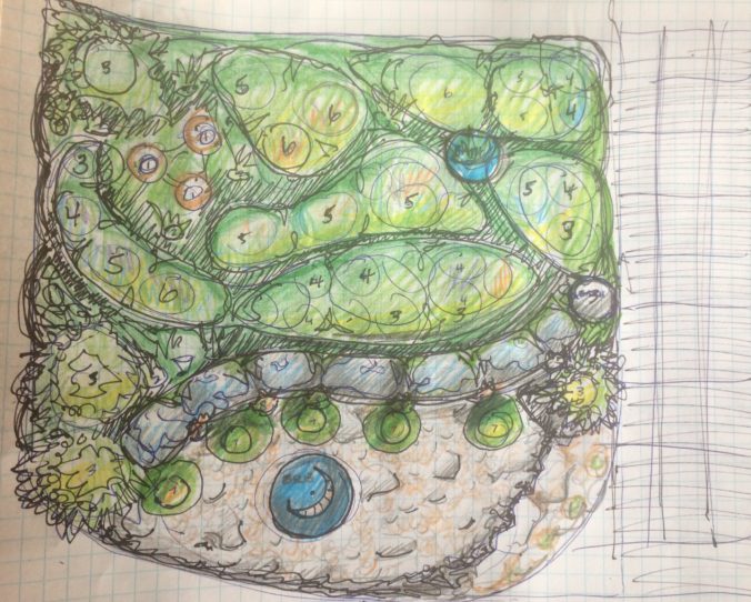
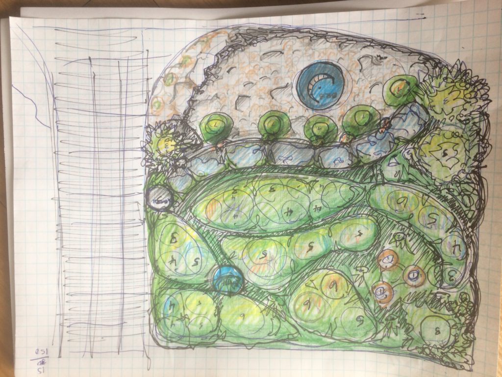
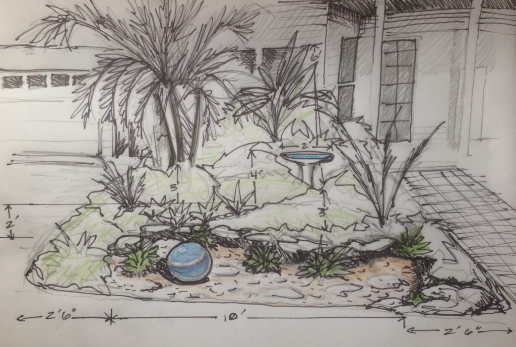
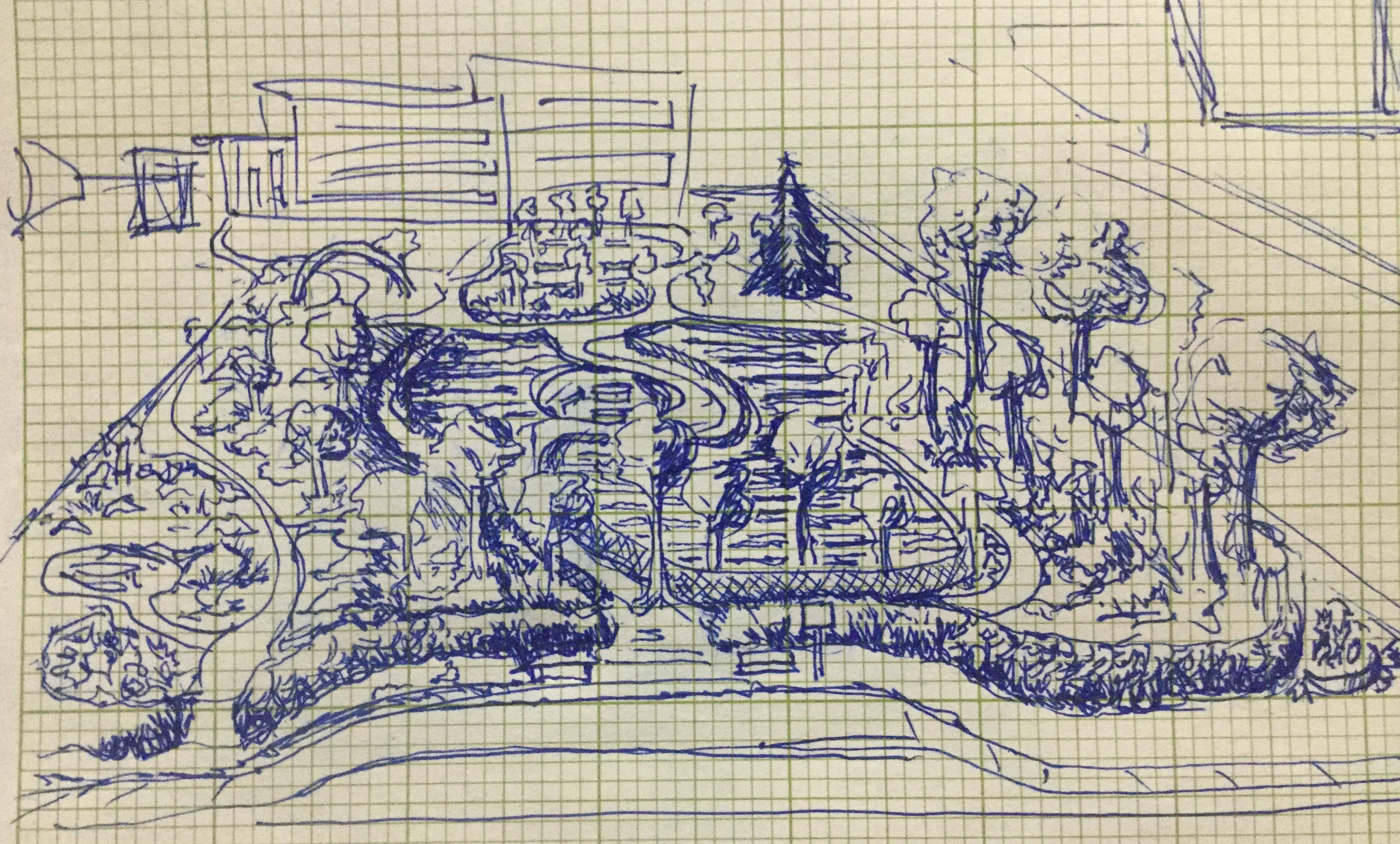
The first draft concept of the project transforms the west side of the walkway into a small oasis of subtropical varieties. A curved low-lying wall of smooth, flat boulders encases a drainage bed dressed with a variety of sizes of decorative river stones, succulents. An over-sized aqua blue planter punctuates the garden. A small bird bath hidden among the shade offers feathered friends a convenient place to quench thirst on a hot day.
A home owner near Sarasota, Florida is planning a make-over of her home. She values the natural, wants to avoid chemicals and enjoy healthy living.
She is used to living in a more contemporary house, and is looking to increase the overall appeal of her home, inside and out.
While this project has not been approved, it offers an inside look at some of the basic factors affecting a natural approach to yards, gardens and farms in Florida.
Each project offers benefits and challenges. The following narrative is our initial summary, but is not extensive or final. Except for the sketches and photographs of the client’s home, any images provided are for demonstration and examples of similar work, not necessarily our own. We give credit and provide links to sources.
Other factors that will ultimately dictate (or affect) decisions on final design and plant selection include owner goals/preferences for the property, desired yield/crop, latitude, longitude, hardiness zones, micro climates, prevailing winds, soil pH, annual rainfall, distribution of precipitation, HOA restrictions, zoning and ordinances and so forth.
Note that while natural farming and gardening methods are rooted in science, many interpretations and preferences on projects/solutions differ. The information we provided here is useful for example purposes but we reserve right of ownership and commercial use. The contained information is not guaranteed, nor are the proposed solutions and technology appropriate in all situations. We are not liable for your use or application of the concepts.
Objective:
Cultivate an attractive assortment of low-maintenance plant species, with special attention to water retention/diversion, the soil’s ecology and soil life as it pertains to nutrient production.
Summary:
After looking at the site, soil and hearing the history of plants on site, it is evident that there are enough natural resources for an appealing design – sun, water, space, oxygen, nutrients. There are a few key issues are limiting the ability of plants to grow and thrive. This could include a particular plant’s preference, needs, but most importantly, the soil looks mostly sandy, devoid of life, extremely dry and prone to overheating and draining. These issues and solutions will be discussed below.
Existing landscape:
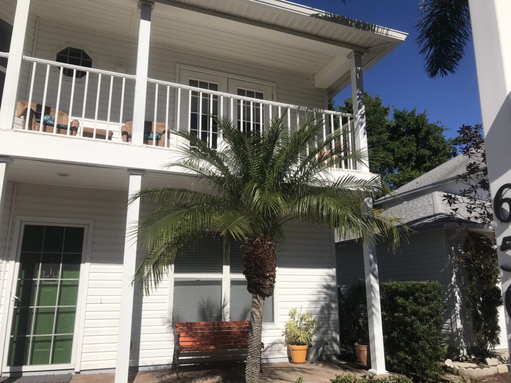
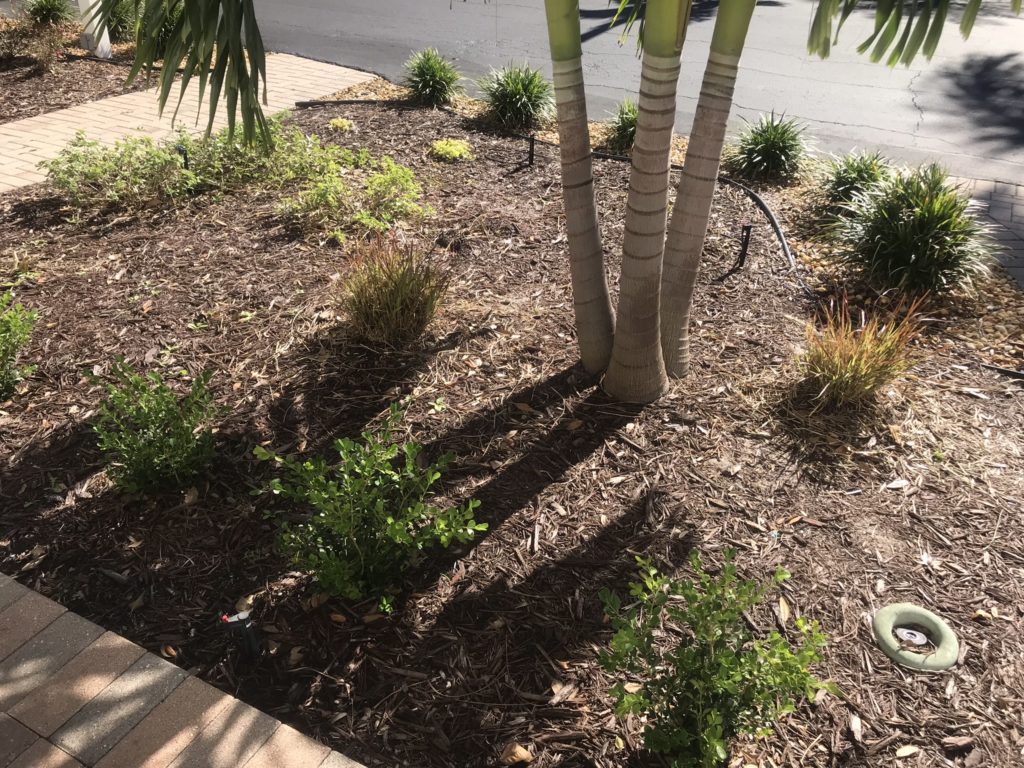
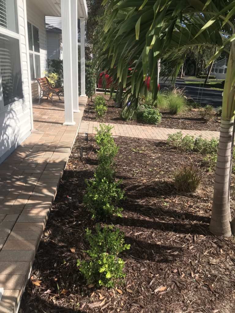
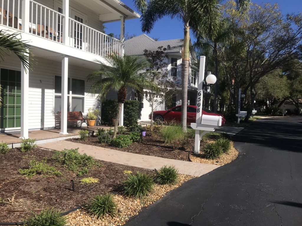
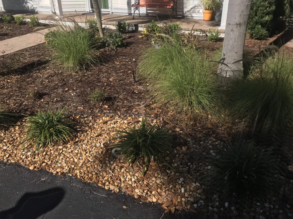
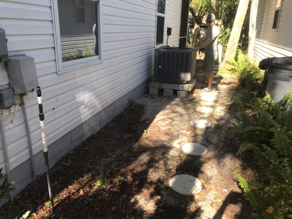
In the front yard (south facing) there is a 3-5% grade sloping away from home with approximately 15’ from porch to curb and 30′ between driveway and corner of lot. Soil settlement test shows a soil composition of roughly 66% sand, 34% organic material from store-bought mulch, virtually no silt or clay, and very little microbial activity. After a week in a jar, there is no smell or aroma to the water/soil mixture whatsoever. The area receives a direct, full sun without obstruction.
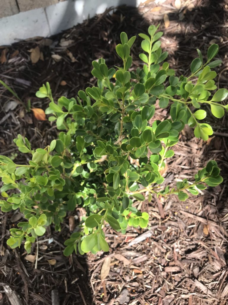
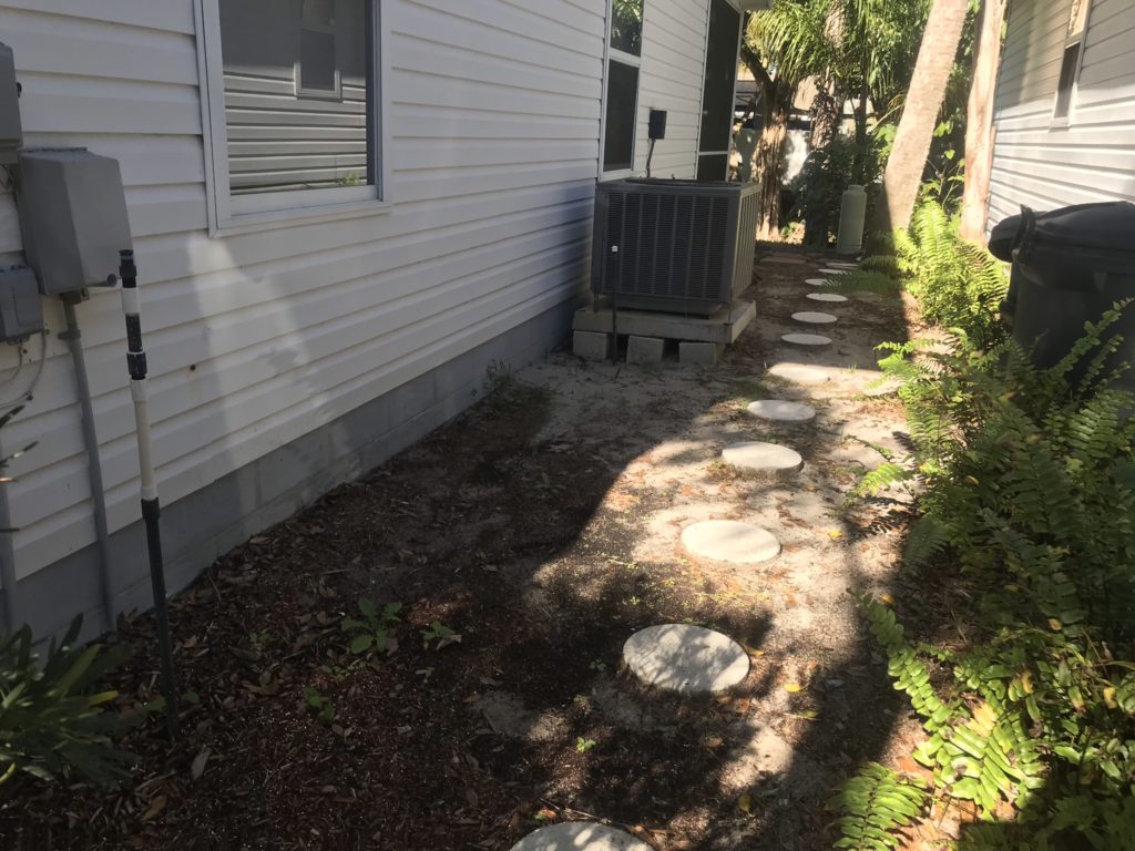
The owner says, some hardy varieties are able to grow, as seen in the photographs. Our goal is to address the water retention and help the soil sustain microbial life. We can then look at the microclimate zones, and list out a variety of plants, based on guild, function, size, shape and color.
Our client is concerned about chemicals. In preparing the contours correctly, we hope to allow soils to regenerate over the years with minor amendments and care on a regular basis. Though we can’t prevent the wind from bringing stray contaminants, or mother nature from bringing storm events, we work to increase biodiversity, improve plant health, reduce the impact of pests. These will reduce the need for direct application of artificial fertilizer, herbicides or insecticides through good plant selection, care and integrated pest management.
Solution:
Our proposed ecological solution for this (and any site) requires a heightened level of observation, study and patience to create the greatest impact with the minimum amount of effort over the long term.
Since form follows function in designs that work with, rather than against the natural, the end aesthetic result can be estimated but is not exact. Investing extra time to understand the issues and intelligently apply concepts, chose plant species so it fulfills multiple functions, not just color or size, will ensure the ecosystem we create can fight off disease and stay healthy – a healthy plant is a beautiful plant.
Quick side view sketch of holding area and runoff to drainage area.
Direct Issues to be resolved:
Rainfall diversion and retention
Soil composition and characteristics
Excess heat/sun
Permitting/specification restrictions and standards
Photo credits
(1) Rainfall, storm events, water diversion & retention:
The area is small enough that it will only require a simple network of hand-dug microswales around two settlement areas to achieve the desired effect. As these overflow, runoff spills over to a drainage swale dressed aesthetically as a dry brook surrounded by grasses and plants that will help prevent erosion and create a look that is natural and contemporary.
Using small and large stones mimics a dry river bed and adds stability. The two “ponds,” will be approximately 18-24” deep by 60-90” wide, or as large as the area will permit. The excess (overflow) from these two ponds is diverted into the drainage area, which drains into a 50′ stone path that doubles as a dry creek bed (or french drain) which is routed to an existing storm-water collection area in the backyard.
The fringe of this path should be lined with stones of a size that prevents them from being washed away in heavy rainfall, while also protecting the soil/sand in planted areas outside the swale. The image below is a good representation, but if used as a walking path, should be topped with flat stones. If budget permits, geotextile cloth and clay could be effective in these areas as a barrier between the drainage rock and existing sand.
Note that except in extreme cases there should be no water running above ground. The path will retain its function even when water is present below the surface. The existing sand would be replaced down to the level of drainage from the front yard, filled with drainage rock and topped with larger pavers, natural or architectural, suitable for walking.
Regarding the stormwater collection area in the back. Future improvements could turn it into a functional rain garden. Raingardens are designed to increase appeal, prevent erosion and ease burden on the municipal system.
(2) Soil composition and characteristics:
Typical soils in Florida are 90% or more sand. Builders’ fill is even worse as a growing medium because it has little support and nutrients. If you limit plant selection to what will grow in these conditions naturally, it will will be almost impossible to achieve a lush and physically healthy landscape. It’s important to add organic material in large quantities. Doing so won’t guarantee they remain, as heat and sun break these down, and rain washes them quickly away. Diverting water so it doesn’t wash directly through, and that the area is at least partially protected from sun is crucial.
Once the initial storm water is diverted, remaining water which has filled the subterranean catchment pond can slowly permeate soil via capillary attraction, keep it moist, and be drawn on from by surrounding plants, fungal mycelia and microbes. The mass of moisture will provide cooling and soil temperature stability. The water should be kept below surface to prevent evaporation, algae growth and keep insect breeding to a minimum.
Image credit
Over time, plant roots and leaves that fall to the ground die and decay will become forage for the life that builds beneath the soil. Even using all of this will not be enough to start the project and replenish all that has been stripped away in the building process. We have to get creative and be proactive in bringing in material. It also takes time to mature.
A small protected area for composting will serve to pile dead leaves and kitchen scraps, so our client can make use of wastes to create mulch and nutrients. We build a containment bin as part of the project. Once set, the pile should be turned a few times a week by client. With the right mindset, this practice becomes a part of the routine, and the basis for yard care.
Illustration credit
Applying decaying organic matter and natural nutrients to the soil, then covering with a mulch will ensure that they are protected from the sun, and they continue to build during the early stages of transition for young plants. This underlying activity generates the tilth and texture that supports lifeforms that convert the organic matter to elemental levels and humus to hold nutrients and moisture which can then be absorbed by plant roots.
The capacity of the soil to support plants strengthens with age as habitat is restored and the diversity of local species increases to include single- and multi-celled organisms, larger living things such as nemetodes, worms, birds and a variety of insects that all act together to pollinate plants, spread seeds, fertilize, purify and consume decay.
(3) Excess heat/sun:
The desired visual effect is stepped, where the plants closest to the street are short, and taller toward the house. The image to the right is a similar landscape, with a small swale out front, backed by a more moist area offering greater variety of tightly spaced and alternating plant species.
Sketch outlining plant heights and depths if using a stepped effect to showcase the property. Optimally, we would plant a stand of taller trees toward front west (left) or middle side of yard to a to break up and reduce the amount of sun hitting the front yard in the afternoon.
Though stepping is possible, it’s not optimal. It’s important to create a canopy of shade to protect the understory and home from the hot summer sun, while also not blocking the prevailing south wind during the summer. There are already a few trees in the front yard which should be saved to provide shade and wind protection for the more sensitive plant growth, understory and ground cover. Smaller trees and shrubs, and a few more trees strategically planted within each existing stand will be sufficient to improve shade and reduce heat. Note, the clean yet natural look achieved with large, flat stones – a viable architectural option for your design.
Specifications, Permitting & Standards:
Per Florida Statute 373.185, any landscaping activity that follows “Florida-Friendly™” practices are protected, and will not be prohibited by any covenant, because they aim to benefit not only home-owners, but the ecology and health of Florida and the community at large.
For this design, we will support natural, chemical-free and Florida-friendly gardening practices. We combine these principles with aesthetic inspired by you (the client) and a function that improves the value and longevity of your property. The final solution, if successful, will do all of this while complementing surrounding architecture and having a positive role in preserving Florida’s natural ecology.
Since we will not be applying artificial fertilizers, no applicators’ permit will be required. No heavy machinery will be required. We will require a municipal ground locate of utilities, and by employing hand digging labor, we have the ability to work carefully to avoid any existing utilities. No changes to grade are necessary, only employment of barriers between planted areas and drainages to slow water and prevent runoff from leaching organic debris and as a result, foster a healthy root zone with observable microbial process, the foundation of life in the “soil food web.”
Other factors to consider:
Insects & wildlife
Time/schedule
Insects & wildlife
Increasing biodiversity will have an impact on the landscape, as insects and animals are naturally attracted to the life, shelter and food that healthy foliage brings. We can prepare but not predict all changes that will occur, and small adjustments will be needed to provide for all living things that may arrive
Insect hotel and artificial beehives (RIGHT: some bugs pollinate, others prey on insects that could damage plants)
Bird bath, feeders and houses (birds eat insects, pollinate, and fertilize)
Bat houses (bats eat insects, pollinate and fertilize)
Bee-friendly flowers
Florida-friendly plant species (zero tolerance for invasive species)
Companion plants (some attract and repel specific species, and some are poisonous to wildlife and humans)
Urban homesteading features, animals and plants used for fertilizer or fodder
Time/schedule
Design/Estimate with you and myself, 3-7 days
Price and order materials, organize labor, set budget
Schedule pickup for discarded materials
Schedule delivery of rock and materials
Source mulch and organics
Select compost area and bin style
Research appropriate plant varieties (I’ll provide lists. You source and purchase.)
Provide concept sketches
Week 2, with 3 people working
Contour and survey, mark out swales and irrigation channels,
Remove excess sand and dig up plants to be saved
Hand dig and trench pools, swale and drainage to backyard
Tie in network of irrigation channels
Start collecting organics from yard – clippings and leaves
Lay fabric and clay, let dry/bake in sun
Timeline/schedule (continued)
Week 3, with 3 people working
Lay wood and organic piles
Lay stones and cover
Mark sites for plants
Purchase plants
Week 4, with 2 people working
Plant plants
Route appropriate irrigation hoses
Cover with mulch
Week 5-10, initial client maintenance with some input
Regular inspections of plants
Adjustments to irrigation systems
Continue gathering and applying organics and mulch
Week 10-52, routine client maintenance with little to no external input
Continue applying finished compost and cover with mulch
Turn compost 3x weekly
Water compost 1x weekly
Prune shrubs and trees annually
Inspect plants weekly
Inspect/repair irrigation as needed
Summary
Our main goals:
Control water and divert runoff
Preserve and build healthy soil
Provide shade plants/trees
Select appropriate plants for your yard, taste and Florida-friendly landscaping
Accommodate biodiversity
Provide input on plant selection and install
The client’s involvement will be heavy during first week, then taper off to just working on plant preferences. We will continue to develop a list of plants that will work well (and that are available within the budget) as we do the installation. They would be present for final completion/hand off and walk through, if any corrections are needed.
After installation, or about 4 weeks, our input is limited to occasional discussions, updates and any follow-on estimates, proposals or contracts.
Due to unpredictability of nature, weather and environment, we can’t guarantee any specific life span of any plant, but which have the best fit for the climate, final soil type and level of care the owner is willing to provide, as the final result does improve or decline with and owner’s continued observation and inputs.
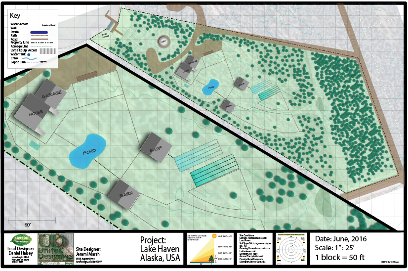
Lake front concept includes many permaculture-based elements – fruit trees, bees, pond, gardens, greenhouse, barn, stable, shop, yurt and aquaponics systems.
Home design integrates stacked shipping containers, and is scheduled to break ground next spring.
Original concept designed on paper, then transferred to Adobe Illustrator for final presentation.
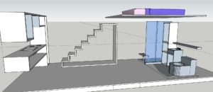
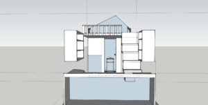
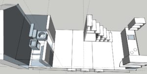
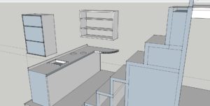
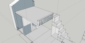
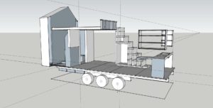
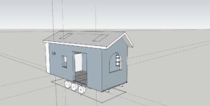
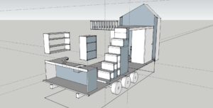
Now that I’ve decided to rent my house out, I need a place to stay. I opted to build my own little space in the back yard and crawl under it during the years to come. I’ll build it on a trailer in case I ever want to move it, but I’m hesitant to even call it a tiny house at this point because it could end up more of a Frankenstein project of a travel trailer.
Because I have no disposable funding, very little time and no one to help, I am sourcing used materials on craigslist and other salvage options. I aim to just get the outside done so I have a warm, dry place to retreat to, and work on the inside when I have time.
Starting small, I will have to pick up the skills along the way. Luckily a guy from New York with some framing skills wants to come to Alaska. I’m hooking him up with a place to stay in exchange for his help. I can’t wait to get started!
Recent Comments